
Introduction
Tiahuanacu (also called Tiwanaku) is a mystery because of its age (estimated to be 17,000 years) and the peculiar stone technology. Today there is little doubt that Tiahuanaco was a major sacred ceremonial centre and focal point of a culture that spread across much of the region. The ancient people built a stone pyramid known as the Akapana
Gateway of the Sun, Tiahuanaco
(courtesy of http://www.sacredsites.com/ and Martin Gray)


View of the Kalisasaya complex (Courtesy Alexei Vranich)

Entrance to Kalasayaya temple, Tiahuanaco, Bolivia
(courtesy of http://www.sacredsites.com/ and Martin Gray)That structure dominates the bottom half of this aerial photo.When first discovered the pyramid was largely covered with soil. After several decades of excavation some of the walls have been uncovered and treasure hunters opened a depression in the top. This was built originally to open towards the east. The dark line across the lower part of the picture is the railway line from a lakeside port to La Paz, the Bolivian capital. The rectangular outline just 'above and to the left ' of the Akapana is a terreplein. known as the Kalasasaya. The lighter patch with an indistinct outline 'above' the Akapana is where an excavated semi-subterranean 'temple' has been discovered. Other features are visible but most of the 'patches' are fields. The upper part of the picture is crossed by the road from the the village of Tiwanaku leading eastwards to La Paz. (taken from 'Pathways to the Gods' by Tony Morrison 1978).
PERU Incidents of Travel and Exploration in the LAND OF THE INCAS
by E. George Squier, New York, Harper and Brothers, 1877.
NOTE: This excerpt serves to provide a description of the ruins before the harvesting of many stones for railroad construction. It also provides insights into some nineteenth-century attitudes towards archaeology sites by and the racism of its author, cited writers, and the local priest (cura) in Tiahuanaco village.
CHAPTER XV. TIAHUANUCO, THE BAALBEC OF THE NEW WORLD.
Tiahuanuco a Centre of Ancient Civilization.-Difficulties.-The Chuño Festival.-Death of my Photographer.-Studying the Art.-My Assistants.-The Edifices of Ancient Tiahuanuco.-The Ruins a Quarry for Modern Builders.-Their Extent. -The Temple.-The Fortress.-The Palace.-The Hall of Justice.-Precision of the Stone-cutting.-Elaborate Sculptures.-Monolithic Gate-ways.-The Modern Cemetery.-The Sanctuary.-Symbolical Slab.-The great Monolithic Gate-way. -Its Elaborate Sculptures.-Monuments described by Cieza de Leon and D'Or-bigny.-Material of the Stone-work.-How the Stone was cut.-General Resume. -Tiahuanuco probably a Sanctuary, not a Seat of Dominion.
TIAHUANUCO lies almost in the very centre of the great terrestrial basin of lakes Titicaca and Aullagas, and in the heart of a region which may be properly characterized as the Thibet of the New World. Here, at an elevation of twelve thousand nine hundred feet above the sea, in a broad, open, unprotected, arid plain, cold in the wet and frigid in the dry season, we find the evidences of an ancient civilization, regarded by many as the oldest and the most advanced of both American continents.
It was to explore and investigate the monumental remains that have made this spot celebrated that I had come to Tiahuannco, and I lost no time in commencing my task. This was not an easy one, for even with the aid of the drunken Cura we were unable to procure laborers to assist us, for not only had we reached the village on the eve of the Chuño, or potato festival, a remnant of ancient observances, but before we had finished our work the Feast of Corpus Christi had commenced. Chicha flowed like water, and the few inhabitants that the Chuño festival had left sober deliberately gave themselves up to beastly intoxication.
This was not my only difficulty. While we were toiling our way upwards through the mountain road, my photographer, on whose skill I had depended, became dangerously ill. One bitter night, under an ebon sky, with no one to assist us save some kindly Indians, we tried in vain to relieve his sufferings and compose his mental hallucinations. The disease baffled all our efforts, and before sunrise death brought him relief and release. He murmured something in the Gaelic tongue, in which only the endearing word "mamma"—sacred in all languages—was intelligible, and died with that word lingering on his thin, blue lips.
I had provided myself with a complete and costly set of photographic apparatus, which I regarded as indispensable to success in depicting the ancient monuments; but I had little knowledge of the art, and must now become my own photographer, or lose many of the results of my labor. With no instruction except such as I could gain from Hardwick's" Manual of Photographic Chemistry," I went to work, and, after numerous failures, became tolerably expert. I had but a single assistant, Mr. H-, an amateur draughtsman, and only such other aid as I could get from my muleteer and his men, who were eager to conclude their engagement, and simply astounded that we should waste an hour, much more that we should spend days, on the remains of the heathens. Still, the investigation was undertaken with equal energy and enthusiasm, and, I am confident, with as good results as could be reached without an expenditure of time and money which would hardly have been rewarded by any probable additional discoveries. We spent a week in Tiahuanuco among the ruins, and, I believe, obtained a plan of every structure that is traceable, and of every monument of importance that is extant.
The first thing that strikes the visitor in the village of Tiahuanuco is the great number of beautifully cut stones, built into the rudest edifices, and paving the squalidest courts. They are used as lintels, jambs, seats, tables, and as receptacles for water. The church is mainly built of them; the cross in front of it stands on a stone pedestal which shames the symbol it supports in excellence of workmanship. On all sides are vestiges of antiquity from the neighboring ruins, which have been a real quarry, whence have been taken the cut stones, not only for Tiahuanuco and all the villages and churches of its valley, but for erecting the cathedral of La Paz, the capital of Bolivia, situated in the deep valley of one of the streams falling into the river Beni, twenty leagues distant. And what is true here is also true of most parts of the Sierra. The monuments of the past have furnished most of the materials for the public edifices, the bridges, and highways of the present day.
The ruins of Tiahuanuco have been regarded by all students of American antiquities as in many respects the most interesting and important, and at the same time most enigmatical, of any on the continent. They have excited the admiration and wonder alike of the earliest and latest travelers, most of whom, vanquished in their attempts to penetrate the mystery of their origin, have been content to assign them an antiquity beyond that of the other monuments of America, and to regard them as the solitary remains of a civilization that disappeared before that of the Incas began, and contemporaneous with that of Egypt and the East. Unique, yet perfect in type and harmonious in style, they appear to be the work of a people who were thorough masters of an architecture which had no infancy, passed through no period of growth, and of which we find no other examples. Tradition, which mumbles more or less intelligibly of the origin of many other American monuments, is dumb concerning these. The wondering Indians told the first Spaniards that "they existed before the sun shone in the heavens," that they were raised by giants, or that they were the remains of an impious people whom an angry Deity had converted into stone because they had refused hospitality to his viceregent and messenger.
I shall give only a rapid account of these remains, correcting some of the errors and avoiding some of the extravagances of my predecessors in the same field of inquiry. I must confess I did not find many things that they have described; but that fact, in view of the destructiveness of treasure-hunters and the rapacity of ignorant collectors of antiquities, does not necessarily discredit their statements; for Tiahuanuco is a rifled ruin, with comparatively few yet sufficient evidences of former greatness.
The ruins are about half a mile to the southward of the village, separated from it by a small brook and a shallow valley. The high-road to La Paz passes close to them—in fact, between them and some mounds of earth which were probably parts of the general system. They are on a broad and very level part of the plain, where the soil is an arenaceous loam, firm and dry. Rows of erect stones, some of them rough or but rudely shaped by art; others accurately cut and fitted in walls of admirable workmanship; long sections of foundations, with piers and portions of stairways; blocks of stone, with mouldings, cornices, and niches cut with geometrical precision; vast masses of sandstone, trachyte, and basalt but partially hewn; and great monolithic doorways, bearing symbolical ornaments in relief, besides innumerable smaller, rectangular, and symmetrically shaped stones, rise on every hand, or lie scattered in confusion over the plain. It is only after the intelligent traveler has gone over the whole area and carefully studied the ground, that the various fragments fall into something like their just relations, and the design of the whole becomes comprehensible.
Leaving aside, for the present, the lesser mounds of earth of which I have spoken, we find the central and most conspicuous portion of the ruins, which cover not far from a square mile, to consist of a great, rectangular mound of earth, originally terraced, each terrace supported by a massive wall of cut stones, and the whole surmounted by structures of stone, parts of the foundations of which are still distinct. This structure is popularly called the" Fortress," and, as tradition affirms, suggested the plan of the great fortress of Sacsahuaman, dominating the city of Cuzco . The sides of this structure, as also of all the others in Tiahuanuco, coincide within ten degrees with the cardinal points of the compass. Close to the left of the Fortress (I adopt this name, and the others I may use, solely to facilitate description) is an area called the "Temple," slightly raised, defined by lines of erect stones, but ruder than those which surround the Fortress. A row of massive pilasters stands somewhat in advance of the eastern front of this area, and still in advance of this are the deeply embedded piers of a smaller edifice of squared stones, with traces of an exterior corridor, which has sometimes been called the "Palace." At other points, both to the south and northward, are some remains to which I shall have occasion to refer.
The structure called the Temple will claim our first attention; primarily because it seems to be the oldest of the group, the type, perhaps, of the others, and because it is here we find the great monolithic sculptured gateway of Tiahuanuco, which is absolutely unique, so far as our knowledge goes, on this continent.
The body of the Temple forms a rectangle of 388 by 445 feet, defined, as I said before, by lines of erect stones, partly shaped by art. They are mostly of red sandstone, and of irregular size and height; those at the corners being more carefully squared and tallest. For the most part, they are between 8 and 10 feet high, from 2 to 4 feet broad, and from 20 to 30 inches in thickness. The portions entering the ground, like those of our granite gateposts, are largest, and left so for the obvious purpose of giving the stones greater firmness in their position.
These stones, some of which have fallen and others disappeared, seem to have been placed, inclining slightly inwards, at approximately 15 feet apart, measuring from centre to centre, and they appear to have had a wall of rough stones built up between them, supporting a terre-plein of earth, about 8 feet above the general level of the plain. On its eastern side this terre-plein had an apron or lower terrace 18 feet broad, along the edge of the central part of which were raised ten great stone pilasters, placed 15 1/2 feet apart, all of which, perfectly aligned, are still standing, with a single exception. They are of varying heights, and no two agree in width or thickness. The one that is fallen, which was second in the line, measures 13 feet 8 inches in length by 5 feet 3 inches in breadth. It is partly buried in the earth, but shows 32 inches of thickness above ground. Among those still erect the tallest is 14 feet by 4 feet 2 inches, and 2 feet 8 inches; the shortest 9 feet by 2 feet 9 inches, and 2 feet 5 inches. These are less in dimension than the stones composing the inner cell or sanctum of Stonehenge , which range from 16 feet 3 inches to 21 feet 6 inches in height; but they are nearly, if not quite, equal with those composing the outer circle of that structure. They are much more accurately cut than those of Stonehenge , the fronts being perfectly true, and the backs alone left rough or only partially worked. The tops of the taller ones have shoulders cut into them as if to receive architraves; and as this feature does not appear in the shorter ones, it may be inferred that their tops have been broken off, and that originally they were all of one length. And here I may call attention to another singular feature of this colonnade—namely, that the sides or edges of each erect stone are slightly cut away to within six inches of its face, so as to leave a projection of about an inch and a half, as if to retain in place any slab fitted between the stones, and prevent it from falling outwards. The same feature is found in the stones surrounding the great mound or Fortress, where its purpose becomes obvious, as we shall soon see.
Such is the general character of the exterior propylon, if I may so call it, of the structure called the Temple. But within the line of stones surrounding it there are other features which claim our attention. I have said that the interior is a mound of earth raised about eight feet above the general level. But in the centre and towards the western side is an area sunk to the general level, 280 feet long by 190 feet broad. It was originally defined on three sides by walls of rough stones which rose above the surface of the mound itself, but which are now in ruins. If this sunken area communicated in any way with the more elevated interior parts of the structure, the means of communication, by steps or otherwise, have disappeared. Across the end of the area not shut in by the mound, the line of stones which surrounds the Temple is continued without interruption; but outside and connected with it is part of a small square of lesser stones, also erect, standing in the open plain.
Regarding the eastern side of the Temple , marked by the line of pilasters which I have described, as the front, we find here, at the distance of 57 feet, the traces of a rectangular structure, to which I have alluded as the" Palace," which was composed of blocks of trachyte admirably cut, 8 to 10 feet long by 5 feet broad, with remains of what appears to have been a corridor 30 feet broad extending around it. The piers which supported the Palace still remain, sunk deep in the ground, apparently resting on an even pavement of cut stones. Remove the superstructures of the best-built edifices of our cities, and few, if any, would expose foundations laid with equal care, and none of them stones cut with such accuracy, or so admirably fitted together. And I may say, once for all, carefully weighing my words, that in no part of the world have I seen stones cut with such mathematical precision and admirable skill as in Peru, and in no part of Peru are there any to surpass those which are scattered over the plain of Tiahuanuco. The so-called Palace does not seem to have been placed in any symmetrical relation towards the Temple, although seemingly dependent on it; nor, in fact, do any of the ancient structures here appear to have been erected on any geometric plan respecting each other, such as is apparent in the arrangement of most of the remains of aboriginal public edifices in Peru.
The Fortress stands to the southwest of the Temple , the sides of the two coinciding in their bearings, and is 64 feet distant from it. As I have already said, it is a great mound of earth, originally rectangular in shape, 620 feet in length and 450 in width, and about 50 feet high. It is much disfigured by the operations of treasure-seekers, who have dug into its sides and made great excavations from the summit, so that it now resembles rather a huge, natural, shapeless heap of earth than a work of human hands. The few of the many stones that environed it, and which the destroyers have spared, nevertheless enable us to make out its original shape and proportions. There are distinct evidences that the body of the mound was terraced, for there are still standing stones at different elevations, distant horizontally nine, eighteen, and thirty feet from the base. There may have been more terraces than these lines of stones would indicate, but it is certain that there were at least three before reaching the summit. This coincides with what Garcilasso tells us of the mound when first visited by the Spaniards. He says, speaking of the ruins under notice: "Among them there is a mountain or hill raised by hand, which, on this account, is most admirable. In order that the piled-up earth should not be washed away and the hill leveled, it was supported by great walls of stone. Noone knows for what purpose this edifice was raised." Cieza de Leon, who himself visited Tiahuanuco soon after the Conquest, gives substantially the same description of the so-called Fortress.
On the summit of this structure are sections of the foundations of rectangular buildings, partly undermined, and partly covered up by the earth from the great modern excavation in the centre, which is upwards of 300 feet in diameter, and more than 60 feet deep. A pool of water stands at its bottom. This latest piece of barbarism was, however, only in continuation of some similar previous undertaking. All over the Fortress and on its slopes lie large and regular blocks of stone, sculptured with portions of elaborate designs, which would only appear when the blocks were fitted together.Some portions of the outer or lower wall are fortunately nearly intact, so that we are able to discover how it was constructed, and the plan and devices that were probably observed in all the other walls, as well as in some parts of the Temple. In the first place, large, upright stones were planted in the ground, apparently resting on stone foundations. They are about ten feet above the surface, accurately faced, perfectly aligned, and inclining slightly inwards towards the mound. They are placed seventeen feet apart from centre to centre, and are very nearly uniform in size, generally about three feet broad and two feet in thickness. Their edges are cut to present the kind of shoulders to which I alluded in describing the pilasters in front of the Temple , and of which the purpose now becomes apparent. The space between the upright stones is filled in with a wall of carefully worked stones. Those next the pilasters are cut with a shoulder to fit that of the pilaster they adjoin; and they are each, moreover, cut with alternate grooves and projections, like mortise and tenon, so as to fit immovably into each other horizontally. Vertically they are held in position by round holes drilled into the bottom and top of each stone at exact corresponding distances, in which, there is reason to believe, were placed pins of bronze. We here see the intelligent devices of a people unacquainted with the uses of cement to give strength and permanence to their structures. Nearly all the blocks of stone scattered over the plain show the cuts made to receive what is called the T clamp, and the round holes to receive the metal pins that were to retain the blocks in their places, vertically.The Fortress has on its eastern side an apron, or dependent platform, 320 by 180 feet, of considerably less than half the elevation of the principal mound. Like the rest of the structure, its outline was defined by upright stones, most of which, however, have disappeared. The entrance seems to have been at its southeast corner, probably by steps, and to have been complicated by turnings from one terrace to another, something like those in some of the Inca fortresses.The tradition runs that there are large vaults filled with treasure beneath the great mound, and that here commences a subterranean passage which leads to Cuzco, more than four hundred miles distant. The excavations certainly reveal some curious subterranean features. The excavation at its southwest corner has exposed a series of superimposed cut stones, apparently resting on a pavement of similar character, twelve feet below the surface. It is said that Von Tschudi, when he visited the ruins, found some "caverns" beneath them (but whether under the Fortress or not does not appear), into which he endeavored to penetrate, but "was glad to be pulled out, as he soon became suffocated." I found no such subterranean vaults or passages in any part of Tiahuanuco; but I do not deny their existence.To the southeast of the Fortress, and about two hundred and fifty paces distant, is a long line of wall in ruins, apparently a single wall, not connected with any other so as to form an enclosure. But beyond it are the remains of edifices of which it is now impossible to form more than approximate plans. One was measurably perfect when visited by D'Orbigny in 1833, who fortunately has left a plan of it, more carefully made than others he has given us of ruins here or elsewhere. Since 1833, however, the iconoclasts have been at work with new vigor. Unable to remove the massive stones composing the base of what was called the Hall of Justice, they mined them, and blew them up with gunpowder, removing many of the elaborately cut fragments to pave the cathedral of La Paz. Enough remains to prove the accuracy of D'Orbigny's plan, and to verify what Cieza de Leon wrote concerning these particular remains three hundred years ago.
The structure called the Hall of Justice occupied one end of a court something like that discoverable in the Temple. In the first place, we must imagine a rectangle, 420 feet long by 370 broad, defined by a wall of cut stones, supporting on three sides an interior platform of earth 130 feet broad, itself enclosing a sunken area, or court, also defined by a wall of cut stones. This court, which is of the general level of the plain, is 240 feet long and 160 broad. At its eastern end is, or rather was, the massive edifice distinguished' as the Hall of Justice, of which D'Orbigny says:
"It is a kind of platform of well-cut blocks of stone, held together by copper clamps, of which only the traces remain. It presents a level surface elevated six feet above the ground, 131 feet long and 23 broad, formed of enormous stones, eight making the length and two the breadth. Some of these stones are 25 1/2 feet long by 14 feet broad, and 6 1/2 feet thick. These are probably the ones measured by Oiego de Leon, who describes them as 30 feet long, 15 in width, and 6 in thickness. Some are rectangular in shape, others of irregular form. On the eastern side of the platform, and cut in the stones of which they form part, are three groups of alcoves, or seats. One group occupies the central part of the monument, covering an extent of fifty-three feet, and is divided into seven compartments. A group of three compartments occupies each extremity of the monument. Between the central and side groups were reared monolithic doorways, similar in some respects to the large one, only more simple, the one to the west alone having a sculptured frieze similar to that of the great gateway. In front of this structure, to the west, and about twenty feet distant, is a wall remarkable for the fine cutting of its stones, which are of a blackish basalt and very hard. The stones arc all of equal dimensions, having a groove running around them, and each has a niche cut in it with absolute precision. Every thing goes to show that the variety of the forms of the niches was one of the great ornaments of the walls, for on all sides we find stones variously cut, and evidently intended to fit together so as to form architectural ornaments."
So much for the description of D'Orbigny. I measured one of the blocks with a double niche, which is shown in the engraving of the terrace walls of the Fortress. It is 6 feet 2 inches in length, 3 feet 7 inches broad, and 2 feet 6 inches thick. The niches are sunk to the depth of 3 inches.
One of the monolithic doorways originally belonging to this structure is unquestionably that forming the entrance to the cemetery of Tiahuanuco . This cemetery is an ancient rectangular mound, about a hundred paces long, sixty broad, and twenty feet high, situated midway between the village and the Fortress. Its summit is enclosed by an adobe wall, and, as I have said, the entrance is through an ancient monolithic gateway, of which I give a front and rear view. It is 7 feet 5 inches in extreme height, 5 feet 10 1/2 inches in extreme width, and 16 1/2 inches thick. The doorway, or opening, is 6 feet 2 inches in height, and 2 feet 10 inches wide. The frieze has a repetition of the ornaments composing the lower line of sculptures of the great monolith, but it has suffered much from time and violence. The ornamentation of the back differs from that of the front, and seems to have been made to conform to the style adopted in the interior of the structure.
In making our measurement in the cemetery we disturbed a pack of lean, hungry, savage dogs of the Sierra-an indigenous species—which had dug up the body of a newly-buried child from its shallow, frozen grave, and were ravenously devouring it. They snarled at us with bristling backs and bloodshot eyes as we endeavored to drive them away horn their horrible feast—by no means the first, as the numerous rough holes they had dug, the torn wrappings of the dead, and the skulls and fragments of human bodies scattered around too plainly attested. I subsequently represented the matter to the cura, but he only shrugged his shoulders, ejaculating, "What does it matter? They have been baptized, and all Indians are brutes at the best."
Returning to the Hall of Justice, we find, to the eastward of it, a raised area 175 feet square, and from 8 to 10 feet high, the outlines defined by walls of cut stone. This seems to have escaped the notice of travelers; at least, it is not mentioned by them. In the centre of this area there seems to have been a building about fifty feet square, constructed of very large blocks of stone, which I have denominated the" Sanctuary." Within this, where it was evidently supported on piers, is the distinctive and most remarkable feature of the structure. It is a great slab of stone 13 feet 4 inches square, and 20 inches in thickness. It is impossible to describe it intelligibly, and I must refer to the engraving for a notion of its character. It will be observed that there is an oblong area cut in the upper face of the stone, 7 feet 3 inches long, 5 feet broad, and 6 inches deep. A sort of sunken "portico" 20 inches wide, 3 feet 9 inches long, is cut at one side, out of which opens what may be called the entrance, 22 inches wide, extending to the edge of the stone.
At each end of the "portico" is a flight of three miniature steps leading up to the general surface of the stone, and sunk in it, while at the side of the excavated area are three other flights of similar steps, but in relief. They lead to the broadest part of the stone, where there are six mortises, 8 inches square, sunk in the stone. 6 inches, and forming two sides of a square, of 3 feet 7 inches on each side, and apparently intended to receive an equal number of square columns. The external corners of the stone are sharp, but within six inches of the surface they are cut round on a radius of twelve inches.
I cannot resist the impression that this stone was intended as a miniature representation or model of a sacred edifice, or of some kind of edifice reared by the builders of the monuments of Tiahuanuco. The entrance to the sunken area in the stone, the steps leading to the elevation surrounding it, and the naos opposite the entrance, defined perhaps by columns of bronze or stone set in the mortises and supporting some kind of roof, constituting the shrine within which stood the idol or symbol of worship—all these features would seem to indicate a symbolic design in this monument. The building in which it stood, on massive piers that still remain, was constructed of blocks of stone, some of them nearly fourteen feet in length and of corresponding size and thickness, and was not so large as to prohibit the probability that it was covered in. Looking at the plan of the Temple, and of the enclosure to the area, one side of which was occupied by the building called the Hall of Justice, we cannot fail to observe features suggestive of the plan cut in the great stone which I have called symbolical.
The most remarkable monument in Tiahuanuco is the great monolithic gateway. Its position is indicated by the letter m in the plan. It now stands erect, and is described as being in that position by every traveler except D'Orbigny, who visited the ruins in 1833, and who says it had then fallen down.
I give two views of this unique monument, both from photographs, of some interest to me, as the first it was ever my fortune to be called on to take. It will be seen that it has been broken—the natives say by lightning—the fracture extending from the upper right-hand angle of the opening, so that the two parts lap by each other slightly, making the sides of the doorway incline towards each other; whereas they are, or were, perfectly. vertical and parallel—a distinguishing side two small niches, below which, also on either side, is a single larger niche. The stone itself is a dark and exceedingly hard trachyte. It is faced with a precision that no skill can excel; its lines are perfectly drawn, and its right angles turned with an accuracy that the most careful geometer could not surpass. Barring some injuries and defacements, and some slight damages by weather, I do not believe there exists a better piece of stone-cutting, the material considered, on this or the other continent. The front, especially the part covered by sculpture, has a fine finish, as near a true polish as trachyte can be made to bear.
The lower line of sculpture is 7 1/2 inches broad, and is unbroken; the three above it are 8 inches high, cut up in cartouches, or squares, of equal width, but interrupted in the centre, immediately over the doorway, by the figure in high-relief to which I have alluded. This figure, with its ornaments, covers a space of 32 by 21 1/2 inches. There are consequently three ranges or tiers of squares on each side of this figure, eight in each range, or forty-eight in all. The figures represented in these squares have human bodies, feet, and hands; each holds a sceptre; they are winged; but the upper and lower series have human heads wearing crowns, represented in profile, while the heads of the sixteen figures in the line between them have the heads of condors.
The central and principal figure is angularly but boldly cut, in a style palpably conventional. The head is surrounded by a series of what may be called rays, each terminating in a circle, the head of the condor, or that of a tiger, all conventionally but forcibly treated. In each hand he grasps two staves or sceptres of equal length with his body, the lower end of the right-hand sceptre terminating in the head of the condor, and the upper in that of the tiger, while the lower end of the left-hand sceptre terminates in the head of the tiger, and the upper is bifurcate, and has two heads of the condor. The staves or sceptres are not straight and stiff, but curved as if to represent serpents, and elaborately ornamented as if to represent the sinuous action of the serpent in motion. The radiations from the head—which I have called rays, for want of a better term—seem to have the same action. An ornamented girdle surrounds the waist of this principal figure, from which depends a double fringe. It stands upon a kind of base or series of figures approaching nearest in character to the architectural ornament called grecques, each extremity of which, however, terminates in the crowned head of the tiger or the condor. The face has been somewhat mutilated, but shows some peculiar figures extending from the eyes diagonally across the cheeks, terminating also in the heads of the animals just named.
The winged human-headed and condor-headed figures in the three lines of squares are represented kneeling on one knee, with their faces turned to the great central figure, as if in adoration, and each one holds before him a staff or sceptre. The sceptres of the figures in the two upper rows are bifurcate, and correspond exactly with the sceptre in the left hand of the central figure, while the sceptres of the lower tier correspond with that represented in his right hand. The relief of all these figures is scarcely more than two-tenths of an inch; the minor features are indicated by very delicate lines, slightly incised, which form subordinate figures, representing the heads of condors, tigers, and serpents. Most of us have seen pictures and portraits of men and animals, which under close attention resolve themselves into representatives of a hundred other things, but which are so artfully arranged as to produce a single broad effect. So with these winged figures. Every part, the limbs, the garb, all separate themselves into miniatures of the symbols that run all through the sculptures on this singular monument.
The fourth or lower row of sculpture differs entirely from the rows above it. It consists of repetitions—seventeen in all—smaller and in low-relief, of the head of the great central figure, surrounded by corresponding rays, terminating in like manner with the heads of animals. These are arranged alternately at the top and bottom of the line of sculpture, within the zigzags or grecques, and every angle terminates in the head of a condor.
The three outer columns of winged figures, and the corresponding parts of the lower line of sculpture, are only blocked out, and have none of the elaborate, incised ornamentation discoverable in the central parts of the monument. A very distinct line separates these unfinished sculptures from those portions that are finished, which is most marked in the lower tier. On each side of this line, standing on the rayed heads to which I have alluded, placed back to back, and looking in opposite directions, are two small but interesting figures of men, crowned with something like a plumed cap, and holding to their mouths what appear to be trumpets. Although only three inches high, these little figures are ornamented in the same manner as the larger ones, with the heads of tigers, condors, etc.
These are the only sculptures on the face of the great monolith of Tiahuanuco. I shall not attempt to explain their significance. D'Orbigny finds in the winged figures with human heads symbols or representations of conquered chiefs coming to pay their homage to the ruler who had his capital in Tiahuanuco, and who, as the founder of sun-worship and the head of the Church as of the State, was invested with divine attributes as well as with the insignia of power. The figures with condors' heads, the same fanciful philosopher supposes, may represent the chiefs of tribes who had not yet fully accepted civilization, and were therefore represented without the human profile, as an indication of their unhappy and undeveloped state. By parity of interpretation, we may take it that the eighteen unfinished figures were those of as many chieftains as the ruler of Tiahuanuco had it in his mind to reduce, and of which, happily, just two-thirds had claims to be regarded as civilized, and, when absorbed, to be perpetuated with human heads, and not with those of condors. Another French writer, M. Angrand, finds a coincidence between these sculptures and those of Central America and Mexico, having a corresponding mythological and symbolical significance, thus establishing identity of origin and intimate relationship between the builders of Tiahuanuco and those of Palenque, Ocosingo, and Xochicalco.
Leibnitz tells us that nothing exists without a cause; and it is not to be supposed that the sculptures under notice were made without a motive. They are probably symbolical; but with no knowledge of the religious ideas and conceptions of the ancient people whose remains they are, it is idle to attempt to interpret them. Nowhere else in Peru, or within the whole extent of the Inca empire, do we find any similar sculptures. They are, as regards Inca art, quite as unique in Peru as they would be on Boston Common or in the New York Central Park.
The reverse of the great monolith shows a series of friezes over the doorway, five in number, of which the engraving will give a better idea than any description. Above the entrance on either hand are two niches, twelve by nine inches in the excavation. It will be observed that those on the right have a sort of sculptured cornice above them which those on the left have not. The second one on the left, it will also be observed, is not complete, but evidently intended to be finished out on another block, which was to form a continuation of the wall of which the gateway itself was designed to be a part. Indeed, as I have said, nearly all the blocks of stone scattered over the plain are cut with parts of niches and other architectural features, showing that they were mere fragments of a general design, which could only be clearly apparent when they were properly fitted together.
The lower niches, now on a level with the ground, show that the monolith is sunk deeply in the soil. They exhibit some peculiar features. At each inner corner above and below are vertical sockets, apparently to receive the pivots of a door, extending upwards and downwards seven inches in the stone. D'Orbigny avers that he discovered the stains of bronze in these orifices and I have no doubt that these niches had doors, possibly of bronze, hinged in these sockets, and so firmly that it was necessary to use chisels (the marks of which are plain) to cut into the stone and disengage them. These large niches are 28.2 inches by 18.2 inches wide. On the face of the monolith, on each side of the doorway, but near the edges of the stone, are two mortises 10 inches by 9, and 6 inches deep, and 12 inches by 6, and 3 1/2 inches deep respectively, which are not shown in the drawings published by D'Orbigny and some others.
I very much question if this remarkable stone occupies its original position. How far it has sunk in the ground it was impossible for me to determine, for the earth was frozen hard, and we had no means of digging down to ascertain. D'Orbigny, as I have already said, states it was fallen when he visited it. Who has since raised it, and for what purpose, it is impossible to say. Noone that we could find either knew or cared to know anything about it. It seems to me not unlikely that it had a position in the hollow square of the structure called the Temple, in some building corresponding with that called the Hall of Justice. Or, perhaps, it had a place in the structure enclosing the stone I have ventured to call symbolical. It is neither so large nor so heavy that it may not be moved by fifty men with ropes, levers, and rollers and although we no not know of any reason why it should have been removed from its original position, we know that many of the heaviest stones have been thus moved, including the monolithic doorway at the entrance of the cemetery.
In addition to the various features of Tiahuanuco already enumerated, I must not neglect to notice the vast blocks of unhewn and partially hewn stones, that evidently have never entered into any structure, which lie scattered among the ruins. The positions of two or three are indicated in the plan. The one to the northeast of the Temple is 26 by 17, and 3 1/2 feet aboveground. It is of red sandstone, with deep grooves crossing each other at right angles in the centre, twenty inches deep, as if an attempt had been made to cut the stone into four equal parts. Another of nearly equal dimensions, partly hewn, was between the Temple and the Fortress. Another, boat-shaped and curiously grooved, lies to the northwest of the great mound. It measures upwards of forty feet in length, and bears the marks of transportation from a considerable distance.
There were formerly a number of specimens of sculpture in Tiahuanuco besides the two monolithic gateways I have described. Says Oiego de Leon: "Beyond this hill [referring to the Fortress] are two stone idols, of human shape, and so curiously carved that they seem to be the work of very able masters. They are as big as giants, with long garments differing from those the natives wear, and seem to have some ornament on their heads." These, according to D'Orbigny, were broken into pieces by blasts of powder inserted between the shoulders, and not even the fragments remain on the plain of Tiahuanuco. The head of one lies by the side of the road, four leagues distant, on the way to La Paz , whither an attempt was made to carry it. I did not see it, but I reproduce the sketch of it given by D'Orbigny, merely remarking that I have no doubt the details are quite as erroneous as those of the figures portrayed by the same author on the great monolith. The head is 3 feet 6 inches high and 2 feet 7 inches in diameter; so that if the other proportions of the figure were corresponding, the total height of the statue would be about eighteen feet.
D'Orbigny found several other sculptured figures among the ruins; one with a human head and wings rudely represented; another of an animal resembling a tiger, etc. Castelnau mentions "an immense lizard cut in stone," and other sculptured figures. M. Angrand, whose notes have been very judiciously used by M. Desjardains, speaks of eight such figures in the village of Tiahuanuco, besides two in La Paz , and one, broken, on the road thither. I found but two; rough sculptures of the human head and bust, in coarse red sandstone, one of a man and the other of a woman, standing by the side of the gateway of the church of Tiahuanuco. They are between four and five feet high, roughly cut, much defaced, and more like the idols which I found in Nicaragua, and have represented in my work on that country, than any others I have seen elsewhere.
Among the stones taken from the ruins, and worked into buildings in the town of Tiahuanuco, are a number of cylindrical columns cut from a single block, with capitals resembling the Doric. One of these stands on each side of the entrance to the court of the church, 6 feet high and 14 inches in diameter. There are also many caps of square columns or pilasters, besides numbers of stones cut with deep single or double grooves, as if to serve for water-conduits when fitted together—a purpose the probability of which is sanctioned by finding some stones with channels leading off at right angles, like the elbows in our own water-pipes.
The stones composing the structures of Tiahuanuco, as already said, are mainly red sandstone, slate-colored trachyte, and a dark, hard basalt. None of these rocks are found in situ on the plain, but there has been much needless speculation as to whence they were obtained. There are great cliffs of red sandstone about five leagues to the north of the ruins, on the road to the Desaguadero; and, on the isthmus of Yunguyo, connecting the peninsula of Copacabana with the mainland, are found both basaltic and trachytic rocks, identical with the stones in the ruins. Many blocks, hewn or partially hewn, are scattered over the isthmus. It is true this point is forty miles distant from Tiahuanuco in a right line, and that, if obtained here, the stones must have been carried twenty-five miles by water and fifteen by land. That some of them were brought from this direction is indicated by scattered blocks all the way from the ruins to the lake; but it is difficult to conceive how they were transported from one shore to the other. There is no timber in the region of which to construct rafts or boats; and the only contrivances for navigation are floats, made of reeds, closely bound into cylinders, tapering at the ends, which are turned up so as to give them something of the outline of boats. Before they become water-soaked these floats are exceedingly light and buoyant.
As to how the stones of Tiahuanuco were cut, and with what kind of instruments, are questions which I do not propose to discuss. I may, nevertheless, observe that I have no reason to believe that the builders of Tiahuanuco had instruments differing essentially in form or material from those used by the Peruvians generally, which, it is certain, were of champi, a kind of bronze.
I have thus rapidly presented an outline of the remains of Tiahuanuco-remains most interesting, but in such an absolute condition of ruin as almost to defy inquiry or generalization. Regarding them as in some respects the most important of any in Peru, I have gone more into details concerning them than I shall do in describing the better-preserved and more intelligible monuments with which we shall have hereafter to deal.
We find on a review that, apart from five considerable mounds of earth now shapeless, with one exception, there are distinct and impressive traces of five structures, built of stones or defined by them—the Fortress, the Temple, the Palace, the Hall of Justice, and the Sanctuary—terms used more to distinguish than truly characterize them. The structure called the Fortress may indeed have been used for the purpose implied in the name. Terraced, and each terrace faced with stones, it may have been, as many of the terraced pyramids of Mexico were, equally temple and fortress, where the special protection of the divinity to whom it was reared was expected to be interposed against an enemy. But the absence of water and the circumscribed area of the structure seem to weigh against the supposition of a defensive origin or purpose. But, whatever its object, the Fortress dominated the plain; and when the edifices that crowned its summit were perfect, it must have been by far the most imposing structure in Tiahuanuco.
The Temple seems to me to be the most ancient of all the distinctive monuments of Tiahuanuco. It is the American Stonehenge. The stones defining it are rough and frayed by time. The walls between its rude pilasters were of uncut stones; and although it contains the most elaborate single monument among the ruins, and notwithstanding the erect stones constituting its portal are the most striking of their kind, it nevertheless has palpable signs of age, and an air of antiquity which we discover in none of its kindred monuments. Of course, its broad area was never roofed in, whatever may have been the case with smaller, interior buildings no longer traceable. We must rank it, therefore, with those vast open temples (for of its sacred purpose we can scarcely have a doubt), of which Stonehenge and Avebury, in England, are examples, and which we find in Brittany, in Denmark, in Assyria, and on the steppes of Tartary, as well as in the Mississippi Valley. It seems to me to have been the nucleus around which the remaining monuments of Tiahuanuco sprung up, and the model upon which some of them were fashioned. How far, in shape or arrangement, it may have been symbolical, I shall not undertake to say; but I think that students of antiquity are generally prepared to concede a symbolical significance to the primitive pagan temples as well as to the cruciform edifices of Christian times.
We can hardly conceive of remains so extensive as those of Tiahuanuco, except as indications of a large population, and as evidences of the previous existence on or near the spot of a considerable city. But we find nowhere in the vicinity any decided traces of ancient habitations, such as abound elsewhere in Peru, in connection with most public edifices. Again, the region around is cold, and for the most part arid and barren. Elevated nearly thirteen thousand feet above the sea, no cereals grow except barley, which often fails to mature, and seldom, if ever, so perfects itself as to be available for seed. The maize is dwarf and scant, and uncertain in yield; and the bitter potato and quinoa constitute almost the sole articles of food for the pinched and impoverished inhabitants. This is not, prima facie, a region for nurturing or sustaining a large population, and certainly not one wherein we should expect to find a capital. Tiahuanuco may have been a sacred spot or shrine, the position of which was determined by an accident, an augury, or a dream, but I can hardly believe that it was a seat of dominion.
Some vague traditions point to Tiahuanuco as the spot whence Manco Capac, the founder of the Inca dynasty, took his origin, and whence he started northwards to teach the rude tribes of the Sierra religion and government; and some late writers, D'Orbigny and Castelnau among them, find reasons for believing that the whole Inca civilization originated here, or was only a reflex of that which found here a development, never afterwards equaled, long before the golden staff of the first Inca sunk into the earth where Cuzco was founded, thus fixing through superhuman design the site of the imperial city. But the weight of tradition points to the rocky islands of Lake Titicaca as the cradle of the Incas, whence Manco Capac and Mama Ocllo, his wife and sister, under the behest of their father, the Sun, started forth on their beneficent mission. Certain it is that this lake and its islands were esteemed sacred, and that on the latter were reared structures, if not so imposing as many other and perhaps later ones, yet of peculiar sanctity.
But before starting on our visit to that lake and its sacred islands, I must relate some of the incidents of our stay in Tiahuanuco.
CHAPTER XVI. AT TIAHUANUCO, AND TO THE SACRED ISLANDS.
Suspected of Treasure-hunting.-The Guardian of the Tapadas.-The Potato-feast and Corpus Christi.-The Indian Celebration.-Music, Dancing, and Costumes.-Departure from Tiahuanuco.-Village of Guaque.-Cattle feeding in the Lake.-Tortora Bridge over the Outlet of the Lake.-Entry into the Village of Desaguadero.-A Convivial Cura.-Hospitalities of the Caballeros and Señoritas.-Mine Host the Comandante.-Zepita.-Scenes on the Road.-Comparatively Fertile Region.-Village of Yunguyo.-A Pressing Invitation.-A Dinner Compliment. -A Legal Luminary.
I HAVE no doubt, the Cura of Tiahuanuco believes to this day that our visit to the ruins was for the purpose of digging for treasures, and that we had some itinerario, or guide, obtained from the archives of Old Spain to direct our search.
What the Indians themselves thought, they did not tell us. But on our very first day among the monuments, and within an hour after we had pitched our photographic tent and got out our instruments, we became aware of the presence of a very old man, withered, wrinkled, and bent with the weight of years. His hair was scant and gray, his eyes rheumy, and his face disfigured by a great quid of coca that he carried in one cheek. He wore tattered pantaloons of coarse native cloth, made from the fleece of the llama, kept together by thongs; his poncho was old and ragged; and the long woollen cap, that was pulled low over his forehead, was greasy from use and stiff with dirt. He had an earthen vessel containing water suspended from his waist, besides a pouch of skin containing coca, and a little gourd of unslacked lime. In his hand he carried a small double-edged stone-cutter's pick or hammer. He paid us no perceptible attention, but wandered about deliberately among the blocks of cut stone that strew the ground, and finally selected one of a kind of white tufa, which he rolled slowly and with many a pause up to the very foot of the great monolith, then seated himself on the ground, placed it between his legs, and after preparing a new quid of coca, began to work on the stone, apparently with the purpose of cutting it in halves. He worked at it all day with small effect, and during the whole time neither noticed us nor responded to our questions. Just before returning to the village, in the edge of the chill night, I prevailed on one of our arrieros, who could speak Aymara, to ask him what was his occupation. He got the curt answer from the old man, that he was "cutting out a cross." Every morning he was at the ruins before us, and he never left until after we did at night. All day he pecked away at the stone between his knees, apparently absorbed in his work and oblivious of our presence. After a time we came to look upon him as an integral part of the monuments, and should have missed him as much as the great monolith itself.
One evening I mentioned the old man to the cura, who again put on mystery, took me out for a turn in the plaza, and explained in whispers, heavy with fumes of cañaso, that the old man was nothing more nor less than a spy on our doings, and that we made no movement in any direction that he did not carefully observe. "He is," said the padre, "one of the guardians of the tapadas. He is more than a hundred years old. He was with Tupac Amaru when he undertook to overturn the Spanish power, and he led the Aymaras when they sacked the town of Huancane, and slew every white man, woman, and child that fell into their hands. He is a heathen still, and throws coca on the apachetas. Ah! if I only knew what that old man knows of the tapadas, señor," exclaimed the cura, with fervor, " I should not waste my life among these barbarians ! You can pity me! And for the love of God, señor, if you do come across the treasures, share them with me! I can't live much longer here !" And the padre burst into a maudlin paroxysm of tears.
Von Tschudi, when he was at Tiahuanuco, found or obtained some ancient relics—small stone idols, if I remember rightly—but had not proceeded many miles on his way to La Paz before he was surrounded by a party of Indians from the town, and compelled to surrender them. We suffered no molestation, although there is no doubt we were closely watched, and that the deaf and apparently almost sightless old stone-cutter was a spy on our actions.
I have already said that our visit to Tiahuanuco was coincident in time with the Chuño and Corpus Christi. The population of the place, as indeed of the whole region, is Indian, the white priests, officials, and landed proprietors being so few as hardly to deserve enumeration. These Indians are of the Aymara as distinguished from the Quichua family, and are a swarthier, more sullen, and more cruel race........
Pumapunku (Puma Punka)
Pumapunku, also called “Puma Pumku” or “Puma Puncu”, is part of a large temple complex or monument group that is part of the Tiwanaku Site near Tiwanaku, Bolivia. In Aymara, its name means, “The Door of the Cougar”. The processes and technologies involved in the creation of these temples are still not fully understood by modern scholars. Our current ideas of the Tiwanaku culture hold that they had no writing system and also that the invention of the wheel was most likely unknown to them. The architectural achievements seen at Pumapunku are striking in light of the presumed level of technological capability available during its construction. Due to the monumental proportions of the stones, the method by which they were transported to Pumapunku has been a topic of interest since the temple's discovery.
Of course there is no certainty that this was the reason as the ancient builders left no written records. All the legends have been handed down through the generations.
Tiahuanaco, Archaeoastronomy and Cataclysmic Myths
© Copyright Martin Gray
Reprinted with permission.
Anthropologist and photographer Martin Gray specializes in the study of sacred sites and power places around the world, having visited more than 1000 of these magical sites in 80 countries. Each year he also guides group pilgrimages to different countries and this year is offering magical journeys to Peru/Bolivia in June and Greece in October. More articles by Martin Gray on our web site. For more information, see Martin’s web site at http://www.sacredsites.com/Early in January of 1998, I bought an old Volkswagen van and began a long drive to the lower reaches of South America. Over the next year, rambling 22,000 miles on rough mountain roads and muddy jungle tracks, I visited and photographed more than 150 sacred sites and power places in fourteen different countries. Along the way, I had fascinating experiences, ranging from the scary to the sublime. There were five robberies (three by the police), dramatic encounters with Columbian guerilla fighters, meetings with authentic shamans, nights of wild dancing at Latin discos, and splendid days exploration and meditation at the sacred places.
Eight months into the journey, I ascended the altiplano region of Peru and Bolivia to spend ten weeks criss-crossing the Andean mountains. The Andes birthed several great cultures, including the Inca and that of Tiahuanaco. While the Inca empire is better known and its sites more numerous and visually remarkable, Tiahuanaco is the true sacred center of Andean region. Now almost entirely in ruins, it is to South America what the Great Pyramid is to Egypt and Avebury stone ring is to England. Twelve miles from the coast of sacred Lake Titicaca, Tiahuanaco was the source of the creation myths, the social order, and the extraordinary preoccupation with astronomy that underwrote thousands of years of Andean culture. Yet, for all its importance, Tiahuanaco remains an enigma. This is not because the ruins have not been excavated or studied. Rather, the reason for the enduring mystery of Tiahuanaco derives from some of its structures - and the astronomical alignments of those structures - that indicate a probable construction period far more ancient than any other monumental archaeological site in all of South America.
Driving to Tiahuanaco from Lake Titicaca (where I had spent several days camping on the islands of the Sun and Moon), I found myself again thinking about several questions that had been with me during my long travels from Sedona. Was South America originally inhabited by Paleo-Indians walking across the Bering land bridge during past ages of polar glaciation (the orthodox assumption) or had there been pre-existing sophisticated cultures that had mysteriously disappeared (the alternative theory)? Was there any factual reality behind the many Andean myths of great cataclysms and enormous floods in archaic times? Who was the legendary hero/savior Viracocha that supposedly re-seeded civilization into the Andean regions following the cataclysm? And what is the meaning behind the astonishing stories of contact, indeed settlement, from the mythic land of Atlantis?
Here is one variant of the myth of Viracocha. Long ago in a forgotten time the world experienced a terrible storm with tremendous floods. The lands were plunged into a period of absolute darkness and frigid cold, and humankind was nearly eradicated. Some time after the deluge, the creator god Viracocha arose from the depths of Lake Titicaca. Journeying first to the island of Titicaca (now called Isla del Sol or the Island of the Sun), Viracocha commanded the sun, moon, and stars to rise. Next going to Tiahuanaco (whose original name, taypicala, meant ‘the rock in the center’), Viracocha fashioned new men and women out of stones and, sending them to the four quarters, began the repopulation of the world. With various helpers, Viracocha then traveled from Tiahuanaco (also written as Tiwanaku), bringing civilization and peace wherever he went. Known by other names including Kon Tiki and Tunupa, he was said to have been a bearded, blue-eyed, white man of large stature. A teacher and a healer, a miracle worker and an astronomer, Viracocha is also credited with introducing agriculture, writing, and metallurgy.
I had been reading about Viracocha’s pilgrimage to Tiahuanaco for twenty years and was enchanted to have finally arrived myself. The first thing I noticed is that Tiahuanaco is not a grand visual spectacle such as the ruins of Machu Picchu, Palenque or Teotihuacan. The excavated central part of the city is relatively small and one can walk across it in fifteen minutes. Additionally, there are not a large number of structures to be seen, because so much has been stolen and carted away over the centuries. The next thing I noticed was that the site appeared to be much, much older than the primary construction and habitation period postulated in orthodox archaeology theory. This conventional interpretation theory assumes that the civilization that spawned Tiahuanaco rose around 600 BC and fell into decline sometime soon after 1000 AD. Yet, something about this relatively recent dating didn’t fit with my impression of the place. With more than thirty years of experience exploring and photographing many hundreds of archaeology ruins I have developed something of a sense for gauging the antiquity of these places, and the remains of Tiahuanaco felt very much older than just 2500 years. The orientation of the site was different too; it had a most unusual style. It seemed to have been designed and crafted by a people with artistic, scientific and philosophic sensibilities distinctly different than that of other pre-Columbian cultures.
This same sort of feeling is what motivated Arthur Posnansky, a German-Bolivian scholar, to exhaustively study Tiahuanaco for almost fifty years. Living at the ruins and intimately familiar with them, Posnansky noticed dozens of things that could not be explained by the conventional archeological theory nor slotted into its chronological framework. For example, all over the site were enormous blocks of stone that no known pre-Columbian culture had the technology to fashion or transport. Even more astonishing, the spatial arrangement of these structures - relative to one another and to the stars above - indicated that the initial site engineers had a highly sophisticated knowledge of astronomy, geomancy and mathematics. Let us take a brief tour of some of these structures and reflect on their remarkable qualities.
Tiahuanaco has four (surviving) primary structures, called the Akapana pyramid, the Kalasasaya platform, the Subterranean temple, and the Puma Punku. The ceremonial core of Tiahuanaco was surrounded by an immense artificial moat that archaeologist Alan Kolata believes was “not to provide the Tiwanaku elite with a defensive structure…but rather evoked the image of the city core as an island, not a common, generic island, but the sacred island of Titicaca, the mythic site of world creation and human emergence.” Further commenting on this idea of the mythic centrality of Tiahuanaco, Kolata explains that, “the true name of Tiwanaku was Taypikhala, ‘the stone in the center.’ Such a name had a geocentric and ethnocentric meaning signifying that the city was conceived not only as the political capital of the state but also as the central point of the universe.”
The Akapana pyramid, sometimes called the sacred mountain of Tiahuanaco, is a much eroded, seven-level pyramid measuring some 200 meters on a side and nearly 17 meters tall. Like the nearby Subterranean Temple and the Kalasasaya, the Akapana is precisely oriented to the cardinal directions. Each of the seven levels is constructed with beautifully cut and precisely joined blocks that were faced with panels once covered with metal plaques, carvings, and paintings. In the center of the Akapana’s flat summit is a small, sunken courtyard laid out in the form of a square superimposed over a perfect cross; this courtyard is also oriented to the cardinal directions. Recent excavations of this courtyard, the interior of the pyramid, and the grounds beneath it have revealed an unexpected, sophisticated, and monumental system of interlinked surface and subterranean channels. These channels brought water collected upon the summit down and through the seven levels, where it exited below ground level, merged into a major subterranean drain system underneath the civic/ceremonial core of Tiwanaku, and ultimately flowed into Lake Titicaca.
Commenting on this magnificent engineering, Kolata states, “It is apparent that the complex system of draining the Akapana was not a structural imperative. A much simpler and smaller set of canals could have drained the accumulated water from the summit. In fact the system installed by the architects of Akapana, although superbly functional, is over-engineered, a piece of technical stone-cutting and joinery that is pure virtuosity.” Kolata goes on to wonder about why all this work was done and concludes that, “the Akapana was conceived by the people of Tiwanaku as their principal emblem of the sacred mountain, a simulacrum of the highly visible, natural mountain huacas (sacred places) in the Quimsachata range....The Akapana was Tiwanaku’s principal earth shrine, an icon of fertility and agricultural abundance. It was the mountain at the center of the island-world and may even have evoked the specific image of sacred mountains on Lake Titicaca’s Island of the Sun. In this context, the Akapana was the principal huaca of cosmogenic myth, the mountain of human origins and emergence, which took on specific mytho-historic significance.”
The structure known as the Puma Punka also startles the imagination. It seems to be the remains of a great wharf and a massive, four-part, now collapsed building, and this makes eminent sense for Lake Titicaca long ago lapped upon the shores of Tiahuanaco city, now inland from the lake twelve miles. One of the construction blocks from which the pier was fashioned weighs an estimated 440 tons (equal to nearly 600 full-size cars) and several other blocks are between 100 and 150 tons. The quarry for these giant blocks was on the western shore of Titicaca, some ten miles away. There is no known technology in the ancient Andean world that could have transported stones of such massive weight and size. The Andean people of 500 AD, with their simple reed boats, could certainly not have moved them. Even today, with modern advances in engineering and mathematics, we could not fashion such a structure. How were these monstrous stones moved and what was their purpose? Posnansky suggested an answer, based upon his studies of the astronomical alignments of Tiahuanaco, but that answer is considered so controversial, even impossible, that it has been ignored and censured by the scientific community for fifty years. As such it hasn’t made in into the mainstream history books and therefore hardly anyone knows of the astonishing implications of Posnansky’s findings.
Nearby the Puma Punka and the Akapana pyramid are the Kalasasaya compound and the so-called subterranean temple. It was in these structures that Posnansky made the discoveries that led him to suggest both a great antiquity for Tiahuanaco and an extraordinary use. As part of his studies, Posnansky had conducted precise surveys of all the principal structures of Tiahuanaco. The Kalasasaya structure, a rectangular enclosure measuring about 450 feet by 400 feet, was delineated by a series of vertical stone pillars (the name Kalasasaya means “the standing pillars”) and had an east-west orientation. Utilizing his measurements of the lines of sight along these stone pillars, the orientation of the Kalasasaya, and the purposely-intended deviations from the cardinal points, Posnansky was able to show that the alignment of the structure was based upon an astronomical principle called the obliquity of the ecliptic.
This term, the obliquity of the ecliptic, refers to the angle between the plane of the earth’s orbit and that of the celestial equator, equal to approximately 23 degrees and 27 minutes at the present. The tilt of the obliquity, however, changes very slowly over great periods of time. Its cyclic variation ranges between 22 degrees, 1 minute and 24 degrees, 5 minutes over a period of 41,000 years or 1 degree in 7000 years (this cycle is not to be confused with the better known precessional cycle of 25,920 years or 1 degree of movement every 72 years). The figure that Posnansky determined for the obliquity of the ecliptic at the time of the building of the Kalasasaya was 23 degrees, 8 minutes, and 48 seconds. Based on these calculations, Posnansky was thereby able to date the initial construction of the Kalasasaya and Tiahuanaco to 15,000 BC. This date was later confirmed by a team of four leading astronomers from various prestigious universities in Germany.
This initial construction date, being vastly older than that deemed possible by the prevailing paradigm of history, was (and still is) ridiculed by mainstream archaeologists and prehistorians. But it is not so easy to dismiss Posnansky’s findings as there are other mysteries concerning Tiahuanaco that seem to confirm the great antiquity of the site. Among these are the ancient myths of Tiahuanaco (from throughout the Andean region) that tell of its founding and use in a pre-flood time; the scientific studies that prove a cataclysmic flood did indeed occur some twelve thousand years ago; the utensils, tools, and the fragments of human skeletons that are mixed in with the deepest layers of the flood alluvia (indicating human use of the site prior to the great flood); and the strange carvings of bearded, non-Andean people that are found around the site (replete with sculptural and iconographic details that are completely unique in the western hemisphere).
Posnansky, and other writers such as Graham Hancock, Zecharia Sitchin and Ivar Zapp, have suggested that these findings and the astronomical alignments of the site, strongly point to the likelihood that the original Tiahuanaco civilization flourished many thousands of years before the period assumed by conventional archaeologists. Rather than rising and falling during the two millennia around the time of Christ, Tiahuanaco may have existed during the vastly older time of the last Ice Age, some 15,000 to 20,000 years ago. The implications of this are truly stunning. Tiahuanaco may be (along with Teotihuacan in Mexico, Baalbeck in Lebanon, and the Great Pyramid in Egypt) a surviving fragment of a long lost civilization.
Who were the people of this lost civilization, and where was it located? Readers interested in exploring these mysteries will enjoy Hancock’s fascinating book, Fingerprints of the Gods. In support of his radical ideas concerning the great antiquity of Tiahuanaco, Hancock gives startling proof that the coastline of South America was mapped in extraordinarily accurate detail long before that continent was “discovered” by Europeans. Maps such as Piri Reis map of 1513 and the Oronteus Finaeus map of 1531, depict the coastline of southern South America and - on the same map - accurately show the sub glacial topography of nearby Antarctica beneath its great layer of ice. (Both these maps have notes on their borders saying they were copied from much earlier sources.) Simply stated, this means that some unknown civilization had explored and precisely mapped the then ice-free continent of Antarctica thousands of years before Europeans first sighted it in 1818.
Did these same shadowy people construct and use the enigmatic city of Tiahuanaco? And, if so, what became of them? Is it not highly significant that both ancient myths and modern day geological studies tell of great floods that swept the high Andean altiplano some twelve thousand years ago? There are parallel myths of civilization-destroying floods found in nearly all the ancient cultures of the world, from the same time period. What was the nature of these floods? What caused them? Using the calendrical mathematics of archaeoastronomy to decode the myths, we can discern specific times of comets and continent-shifting earthquakes that impacted human civilization in prehistoric times.
Velikovsky has theorized that an enormous chunk of rock was spun off from the planet Jupiter and that it rampaged as a comet through the inner solar system, nearly colliding with the earth and causing catastrophes spoken about in numerous ancient mythologies. More recently, other scientists have suggested possible causes for the great cataclysms such as the three major periods of glacial melting inundation between 13,000 and 8000 BC, the phenomena of crustal displacement in 9600 BC, and the seven cometary impacts of 7460 BC. In a future issue of Four Corners magazine, I will examine each of these fascinating matters in more detail. As the following quote from Plato reminds us, great catastrophes have visited the earth many times in ages past and will surely do so again.
Anthropologist and photographer Martin Gray specializes in the study of sacred sites and power places around the world, having visited more than 1000 of these magical sites in 80 countries. Each year he also guides group pilgrimages to different countries and this year is offering magical journeys to Peru/Bolivia in June and Greece in October. More articles by Martin Gray on our web site. For more information, see Martin’s web site at http://www.sacredsites.com/...with you and other peoples again and again life has only recently been enriched with letters and all the other necessaries of civilization when once more, after the usual period of years, the torrents of heaven sweep down like a pestilence leaving only the rude and unlettered among you. And so you start again like children, knowing nothing of what existed in ancient times, here or in your own country.
MYTHOLOGY - HISTORY
The ruins of Tiahuanaco city and centre of worship are located on the Altiplano in today's Bolivia, ca 4000 m from water level, and 21 km north-east from Lake Titicaca. Tiahuanaco was a capital of a theocratic state governed by priest kings. The state exerted its influence on the development of the whole southern part of Peru in the closing centuries of the last millennium, expanding its influence in a peaceful manner on the vast highland as well as coastal territory.
Tiahuanaco, therefore, carried out a pacifistic cultural mission quite different from that of its contemporary militant country of Huari (Wari) in the Peruvian Andes. The religious sources of this period are first and foremost archaeological findings, but to a great extent also the recordings of the 16th century chroniclers.
The religion of Tiahuanaco centred around the cult of a sky and thunder god Viracocha. The deity was generally depicted as having staves in both of his hands and an aureole around his head. The aureole suggests the qualities of a sun god, represented on the bas-relief in the upper part of the famous Sun Gate in Tiahuanaco as well as on ceramic.
The staves, on the other hand, suggest Viracocha's distant ancestry from the nearly thousand years older Chavín sky god in North Peru. His attendants were ranking deities in the shapes of cougar, condor, falcon and snake. Viracocha was worshipped as the main god in Huari as well; there his characteristics were apparently more militant. A head of Tiahuanaco state functioned both as a king and the arch-priest and he was revered as Viracocha's embodiment on earth (Kelm 1990: 524-528).
The chronicle records describe the citizens of Tiahuanaco as «the Viracochas», who were fair-skinned and wore white long robes. Viracocha is also described as a man with fair skin and white beard, attired in a long robe and sandals, wearing a staff, with a cougar lying at his feet. He was a kind and peace-loving god who had also subjected the dreadful jaguar-god to his power.
The idea might refer to the Tiahuanaco's peaceful mission among the distant warrior cultures of Peru. According to the legend, however, evil people in short clothes came to the sacred lake and forced Viracocha to leave to north. On his departure they mocked and taunted him for his long robe and lenient disposition. Eventually, he had descended from the highlands to the coast and left over the ocean, promising to return some day
In 1921 one of the leading researchers of Peruvian cultures from the first part of this century José de la Riva Agüero y Osma, who had also studied the chronicle records as well as linguistic and archaeological data for nearly 25 years, published his «theory of the paleo-Quechuan empire».
The theory focused on the hypothesis that Tiahuanaco was originally the cradle and home of the Inca Empire, and the Inca themselves the upper class of the once emigrated Tiahuanaco people. He also argued that the Quechuans, Aymarans and Araucanians had to originate from the same ancient and anthropologically close ancestral nation who spoke a language related to theirs, and was developed to a degree that could influence them, the younger peoples. Riva-Agüero's term for such ancestors was 'paleo-Quechuans' (Busto I s.a.: 186-194).
Even today the Aymarans inhabit the surroundings of Lake Titicaca. They have preserved heritage on their ancient migration and the subjugation of the town people who were driven from the city. Also, the archaeological data supports the idea of the late arrival of the Aymarans. Riva-Agüero speculates that the paleo-Quechuans were now forced to leave among other places for the Cuzco Valley, the later settlement of the Inca.
A chronicler informs us that the first king of the Inca Manco Capac came from Tiahuanaco (Vega 1988: 34-37). We also know that the relationship between the Quechuans and the Aymarans could be characterised by a constant feud which might have been caused by the fugitives' anger towards the invaders.
Agüero also argues that the affinity of the Quechuan and Aymaran languages is due to the existence of a common primal language, possibly the paleo-Quechuan. The archaeological data also confirms the Aymaran immigration.
The chullpa's, or the burial towers around Titicaca belonged supposedly to the Aymarans; still, the earliest settlers of Tiahuanaco mummified their dead similarly to the Inca, similarities could be found also between the pottery from the golden age of Tiahuanaco and that of the Inca - the ceramic ware of Aymarans is considerably different.
The clothing of the Aymarans differed as well, being shorter than the Quechuan dress, which once again supports the legend about the departure of the long-robed Tiahuanacos.
Montesinos, the chronicler, informs us that the priest kings of Tiahuanaco, or los amautas as they were called, fled the country trying to save the cult of their own gods (Busto I s.a.: 191). This is another evidence proving that the Inca originated from the upper class who were forced to leave Tiahuanaco by the militant Aymarans, or los piruas.
The idea of the Inca having been militant aroused from the new circumstances.
The Inca regarded the surroundings of Titicaca as their former home and revered Viracocha as a god who had told them to build the city of Cuzco. Later, the mythology related to Viracocha acquired an important role in the Inca religion.
Thus, we might reason that the founders of the Tiahuanaco culture were the common ancestors of the Quechuans and Aymarans, i.e. the paleo-Quechuans. Presumably, the militant Aymarans crushed Tiahuanaco in the 10th-11th century and forced the majority of the upper class flee northward to the mountain valleys inhabited by other Quechuan kin tribes.
The Aymarans could not destroy the powerful civilisation all at once and founded the kingdom of Colla, which in the 15th century was incorporated into the state of the same Inca who were once driven from their homeland by the Collas. Thus, the hypothesis of Riva-Agüero expanded to a theory which is acknowledged by most of the historians in Peru.
Consequently, the Inca were the genetic and cultural successors of the Tiahuanaco people. According to the archaeological data these Quechuan emigrants arrived at their kin tribes in the Cuzco Valley at the beginning of the 12th century and founded their city-state on the spot.
Since 1538 the Inca ruler Pachacutek Yupanqui employed the necessity of defeating the militant Chancas, subjugated other Quechuan city-states and merged them into the empire that reigned the whole of Peru, northern Chile, northern Bolivia and southern Ecuador until the invasion of Spanish conquistadors.
The archaeological material for the religion of this period is abundant, and can be compared to the detailed accounts of the 16th-17th century Spanish chronicles (Kauffmann Doig 1991: 78).
The highest ranking deity of the Inca was a celestial supreme being who was first known under the name Viracocha, later also as Pachacamak. Originally, Pachacamak was a sky god of the Lurín Valley in central Peru whose name was later given to the sky god of the Inca.
The main god of the Inca state religion was the sun god Inti, who might have been a nature totem of the Quechua or a god of a certain tribe. Another significant deity in the Inca pantheon was the thunder god Illapu who was apparently distinctive from the Tiahuanaco sky god, but was named after a thunder god of the central Peruvian tribes.
Viracocha became the culture hero of the Inca who was said to have brought culture to people, then set off to the Pacific and promised to return. (Kulmar 1999: 101-109).
The Inca myths can be divided in two groups:
- the creation myths
- the origin myths
Creation Myths
The world was created by Viracocha near Lake Titicaca. After the great deluge or the receding of chaotic floodwaters Viracocha descended to earth and created plants, animals and men to the empty land; he built the city of Tiahuanaco and appointed 4 world rulers of whom Manco Capak became the superior of the Ursa Major world, i.e. the north horizon (Busto II 1981: 7).Origin Myths
Myths about the Ayar brothers
Four pairs of brothers-sisters created by Viracocha to rule the world left the cave of Mountain Pacaritambo. The whole world was living in an uncivilised and ignorant manner. The newcomers began with organising the mankind and divided people into ten large communities.
Leading the tribes the brothers set off in search of enough fertile land to sustain themselves. They carried Sunturpaucar, a long staff adorned with colourful feathers, a cage with a sun-bird who could give good advice and other sacred objects in front of them.
Making shorter and longer stops they moved towards Cuzco. In the course of the long journey the group became smaller: the rivalling brothers confined one of their companions to a cave, two others wished to break away but were turned into stones. The only surviving brother Ayar Manco a.k.a. Manco Capak accompanied by his sister and wife Mama Ocllo and his brothers' wives, founded the city of World Pole in the name of Viracocha the Creator and Inti the Sun God, and settled there with his people.
A myth of Manco Capak and Mama Ocllo
A long time ago when the world was filled with savages, misery and poverty, a brother and a sister, a married couple Manco Capak and Mama Ocllo left Lake Titicaca. Inti, the sun god had sent them to refine the surrounding peoples, and gave them a golden stick for testing the land for cultivation and then settling in the suitable place.
Having found such a place they had to found the state, teach the people how to live proper lives and advocate the worship of the sun god. The journey took a long time. Eventually, in the Cuzco Valley the golden stick disappeared into the ground, and they could start with their mission.
Manco Capak taught his people the cultivation and irrigation of land and handicraft, Mama Ocllo taught women spinning, weaving and sewing. The tribe of Manco Capak became to be called by the name of Hanan Cuzco (High Cuzco) and the relatives of Mama Ocllo by the name of Hurin Cuzco (Lower Cuzco).
The city and the state was founded in the name of Viracocha and Inti the sun god, also the Sun Temple was built in Cuzco (Busto II 1981: 10-17).
How to interpret the myths?
María Rostworowski de Díez Canseco argues that the creation of the Inca state is introduced already in the creation myths (Rostworowski 1988: 31-34). Although originally they seemed to function as creation stories about Tiahuanaco culture, they were later apparently customised by the Inca for ideological purposes. The origin of the Inca from the cultural centre around Lake Titicaca has been supported by archaeological data. Editing seems most apparent in accounts of introducing the first legendary ruler Manco Capak, on the one hand, and in dividing the world in four parts, on the other. The Inca state Tahuantinsuyu was also divided into four large provinces ruled by governors.
Recent customisation is even more apparent in the origin myths. Today's scholars argue that both the myth of the Ayar brothers as well as the myth about Manco Capak comes from the same source, whereas the former is older and less edited, the latter more recent and also more edited.
Both versions say that the main character Ayar Manco or Manco Capak had arrived from south and settled in the Cuzco Valley. The part of the story suggests the Tiahuanaco origin of the Inca as well as the flight of the Quechuan elite from the Aymaran invaders.
Leaving Lake Titicaca could serve as a hypothesis that the home of the Inca was located on the Isle of Sun (La Isla del Sol) in Lake Titicaca - according to archaeologists it might have been one of the residences of the upper class Tiahuanaco people. The hypothesis would also explain why Manco Capak was sent by the sun god, as the island became to be called the Isle of Sun only after the sun worship had become the Inca state religion.
In the original version the brothers are sent to refine people by Viracocha, which suggests even the earlier modification of the story from the time when Viracocha was revered as the main god.
The four pairs of brothers-sisters in the original version refers to the four Quechuan tribes who left Tiahuanaco. The married couple consisting of a brother and a sister, in its turn, could be explained by the fact that the Quechuan tribe was exogamous and consisted of two fraterias: in exogamous societies men belong to one frateria and women to another. This could be inferred also from the myth version concerning the division of Cuzco in two - the High and Lower fraterias.
The disposing of all the other Ayar brothers on the journey in the original version refers either to their settling to different places or the feud between the tribes of Manco and the rest of his brothers.
Different accounts confirm that the Inca led to the Cuzco Valley by Manco Capak had to drive local tribes from the land in order to establish themselves there. People from the droughty Altiplano had to search for humid soils necessary for cultivating corn. Therefore, Manco's golden stick was supposed to point to the land where corn could be grown. For settling in the new place a fight was put up, and we all know the outcome of the attack. In fact, chronicler Sarmiento do Gamboa's expression «gloomy and fertile» might refer to the gory battles fought for the fertile valley.
Both versions end with the account of building the city by Manco in the name of Viracocha the Creator and Inti the sun god. The former was originally the sky god of the ancient Tiahuanaco people, whose cult was later abandoned. Inti, on the other hand, was the tribal deity of the Inca who later became the highest ranking god in the pantheon.
The fact that in the later version the instigator of refining people was Inti, and also that a temple to the sun god was first erected in Cuzco suggests that the journey from Altiplano to the Cuzco Valley must have taken a long time, at least a couple of centuries (archaeological data supports the fact that Tiachuanaco was destroyed by the Aymarans in the 10th century, and the Inca reached the Cuzco Valley at the end of the 12th century).
Thus, during this period one deity was substituted for another: Viracocha became deus otiosus, Inti, on the other hand became so popular that the first temple was built for him.
As I mentioned before, the supreme god was given a new name - Pachacamak. From then on, Viracocha was associated with the myth of a culture hero, because:Thus, Manco Capak who supposedly ruled the Inca at the time of their arrival at the Cuzco Valley, became the first half-legendary ruler of the country and started the official Inca dynasty. Certainly, he was nothing more than a tribal chief - it took another two centuries for the Inca civilisation to reach its golden era under the rule of the first emperor Pachacutek Yupanqui (Busto II 1981: 22).
- the fact that the Tiachuanaco people had spread the cult of Viracocha widely in Peru was never forgotten;
- the sc. civilisational emigration of the Inca really did take place;
- the abandoning of the sky god's cult is reflected by the account of Viracocha's set-off to the ocean;
- Viracocha's promise to return refers to the fact that the sky god's cult never really disappeared, and in greatest troubles the Inca still addressed their sky god, as is common for deus otiosus (Kulmar 1999: 101-109).
The founding of city in the name of two gods could be interpreted in a manner uniquely provident and theocratic for the history of the Andean state Tahuantinsuyu: the supreme god Viracocha had provided that Manco's tribe will rule the world, and Manco started to carry it out at the will and guidance of Inti, the sun god. Thus, the civilisational mission of the Inca found a theological explanation as well (see also Soriano 1990: 483-499).
Finally, these origin myths also reveal the ethnocentric world-view of the Quechuans: the Inca believed in the inherent superiority and wisdom of their own people, thinking they were destined to refine the mankind whether other peoples accepted it or not. That could be inferred also from the names of the country and its capital. The name of the Inca empire Tahuantinsuyu stands for «the country of four points of compass» (Vega 1988: 17). Most chroniclers (except for Sarmiento) argue that Cuzco means «pole» (Busto II 1981: 8), i.e. the centre of the world or the world pole.
The analysis of the history and society of the Inca state has confirmed that it was the first and only totalitarian state on the American continent and Pre-Columbian America (Kulmar 1989: 74-76; Soriano 1990: 483-499). The ethnocentric and imperialist origin myth formed the ideological foundation for establishing such a scheme of society, determining also the mentality of its nation by education and in everyday life.
Thus, the Inca built their historical studies and regulations on the ancient Tiahuanaco myths, having customised them according to their own need.
LINKS
- Puma Punku >>
- Tiwanacu >>
- http://www.world-mysteries.com/gw_rnincas.htm


Pumapunku
Coordinates: 16°33′42″S 68°40′48″W / 16.56169°S 68.679931°W
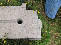
 An example of high-precision small holes (for viewing the image to enlarge).
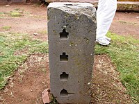
Stone block with a blind holes of complex shape.
Pumapunku also called "Puma Pumku" or "Puma Puncu", is part of a large temple complex or monument group that is part of the Tiwanaku Site near Tiwanaku, Bolivia. In Aymara, its name means, "The Door of the Cougar". The Pumapunku complex consists of an unwalled western court, a central unwalled esplanade, a terraced platform mound that is faced with megalithic stone, and a walled eastern court.[1][2][3] The Pumapunku is a terraced earthen mound that is faced with megalithic blocks. It is 167.36 m wide along its north-south axis and 116.7 m long along its east-west axis. On the northeast and southeast corners of the Pumapunku it has 20-meter wide projections that extend 27.6 meters north and south from the rectangular mound. The eastern edge of the Pumapunku is occupied by what is called the "Plataforma Lítica." The Plataforma Lítica consists of a stone terrace that is 6.75 by 38.72 meters in dimension. This terrace is paved with multiple enormous stone blocks. The Plataforma Lítica contains the largest stone slab found in both the Pumapunku and Tiwanaku Site. This stone slab is 7.81 meters long, 5.17 meters wide and averages 1.07 meters thick. Based upon the specific gravity of the red sandstone from which it was carved, this stone slab has been estimated to weigh 131 metric tons.[4] The core of the Pumapunku consists of clay. The fill underlying selected parts of the edge of the Pumapunku consists of river sand and cobbles instead of clay. Excavations at the Pumapunku have documented “three major building epochs, in addition to small repairs and remodeling.”[1][2][3][4][5]
At its peak, Pumapunku is thought to have been "unimaginably wondrous"[2], adorned with polished metal plaques, brightly colored ceramic and fabric ornamentation, trafficked by costumed citizens, elaborately dressed priests and elites decked in exotic jewelry. Our understanding of this complex is limited due to its age, the lack of a written record, the current deteriorated state of the structures due to treasure hunting, looting, stone mining for building stone and railroad ballast, and natural weathering.[1][2][4]
The area within the kilometer separating the Pumapunku and Kalasasaya complexes has been surveyed using ground-penetrating radar, magnetometry, induced electrical conductivity, and magnetic susceptibility. The geophysical data collected from these surveys and excavations have revealed in the area between the Pumapunku and Kalasasaya complexes the presence of numerous man-made structures. These structures include the wall foundations of buildings and compounds, water conduits, pool-like features, revetments, terraces, residential compounds, and widespread gravel pavements all of which now lie buried and hidden beneath the modern ground’s surface.[6][7]


| Wikimedia Commons has media related to: Puma Punku |
Pumapunku also called "Puma Pumku" or "Puma Puncu", is part of a large temple complex or monument group that is part of the Tiwanaku Site near Tiwanaku, Bolivia. In Aymara, its name means, "The Door of the Cougar". The Pumapunku complex consists of an unwalled western court, a central unwalled esplanade, a terraced platform mound that is faced with megalithic stone, and a walled eastern court.[1][2][3] The Pumapunku is a terraced earthen mound that is faced with megalithic blocks. It is 167.36 m wide along its north-south axis and 116.7 m long along its east-west axis. On the northeast and southeast corners of the Pumapunku it has 20-meter wide projections that extend 27.6 meters north and south from the rectangular mound. The eastern edge of the Pumapunku is occupied by what is called the "Plataforma Lítica." The Plataforma Lítica consists of a stone terrace that is 6.75 by 38.72 meters in dimension. This terrace is paved with multiple enormous stone blocks. The Plataforma Lítica contains the largest stone slab found in both the Pumapunku and Tiwanaku Site. This stone slab is 7.81 meters long, 5.17 meters wide and averages 1.07 meters thick. Based upon the specific gravity of the red sandstone from which it was carved, this stone slab has been estimated to weigh 131 metric tons.[4] The core of the Pumapunku consists of clay. The fill underlying selected parts of the edge of the Pumapunku consists of river sand and cobbles instead of clay. Excavations at the Pumapunku have documented “three major building epochs, in addition to small repairs and remodeling.”[1][2][3][4][5]
At its peak, Pumapunku is thought to have been "unimaginably wondrous"[2], adorned with polished metal plaques, brightly colored ceramic and fabric ornamentation, trafficked by costumed citizens, elaborately dressed priests and elites decked in exotic jewelry. Our understanding of this complex is limited due to its age, the lack of a written record, the current deteriorated state of the structures due to treasure hunting, looting, stone mining for building stone and railroad ballast, and natural weathering.[1][2][4]
The area within the kilometer separating the Pumapunku and Kalasasaya complexes has been surveyed using ground-penetrating radar, magnetometry, induced electrical conductivity, and magnetic susceptibility. The geophysical data collected from these surveys and excavations have revealed in the area between the Pumapunku and Kalasasaya complexes the presence of numerous man-made structures. These structures include the wall foundations of buildings and compounds, water conduits, pool-like features, revetments, terraces, residential compounds, and widespread gravel pavements all of which now lie buried and hidden beneath the modern ground’s surface.[6][7]
Ancient Mysteries - Puma Punku in Tiahuanaco
The Ancient Structures
They are arguably the oldest, and most baffling ruins on the face of the Earth. It is hard to imagine how they did not come to be known as one of the wonders of the world like the Great Pyramid. Spectacular in its own right, the Great Pyramid is, yet it pales in comparison to the ruins of Puma Punku in Tiahuanaco, in South America.
The ruins of Puma Punku are one of four structures in the ancient city of Tiahuanaco. The others three structures are; The Akapana Pyramid, the Kalasasaya Platform, and the Subterranean Temple.
Even with modern day technology and information, these structures defy logic, and confound those who seek to solve the mysteries that lie within them. The ruins of Puma Punku are said to be the most fascinating, and most confusing of all.
Who built these structures?
How were these structures built?
Why were these structures built?
These are all questions on the minds of those researching these ancient structures, and they are not easily answerable, if they can even be answered at all.
Puma Punku
If pyramids were more than difficult to create several thousand years ago, then how much more difficult would it have been to build Puma Punku?
Puma Punku is believed to have once contained a great wharf, and a massive four part structure. Yet all that remains today are megalithic ruins from some cataclysmic event in history. A great earthquake? A comet that came too close to the Earth? A worldwide flood? These are all possible causes to the destruction of the once great structure that is now the ruins of Puma Punku.
Not only is there evidence to support the claim of a cataclysmic flood, but there is even evidence to support the theory that people once lived there before such a flood even occurred. The suspected flood could have happened somewhere around 12,000 years ago, and there is scientific evidence of tools, bones, and other material within flood alluvia, which suggests that a civilized people were there prior to any flood. Other evidence, that being carvings of bearded people that are not Andean, have been recorded throughout the area.
Could the ruins of Puma Punku be evidence of a long lost civilization?
What Makes The Ruins Unique?
It is highly unlikely that any of the stones in Puma Punku were cut using ancient stone cutting techniques, at least not those that we are aware of.
The stones in Puma Punku are made up of granite, and diorite, and the only stone that is harder that those two, is the diamond. If the people who built this place cut these stones using stone cutting techniques, then they would had to have used diamond tools.
If they didn't use diamonds to cut these stones, then what did they use?
Not only were these stones really hard to cut, but they are also extremely heavy. One of these stone ruins weighs in at about 800 tons! These are big stones, and they are really heavy. The nearest quarry is at least 10 miles away from the site of the ruins. How in the world did these people move these blocks that weighed many tons, and how were they able to form a structure with them?
With the technology that we currently have today, it would be extremely difficult to recreate the site of these ruins, if possible at all. If we can't do it, then how did these ancient people accomplish this task? This could have taken place anywhere from 500 b.c. all the way back to the Ice Age.
These ancient people had to have been very sophisticated, knowing astronomy, geomancy, and mathematics. However, there are no records of this work. To build a place like Puma Punku, there must have been significant planning, and writing involved, but there is no record of any of this.
Interlocking Stones
There is one more significant thing to mention regarding the ruins of Puma Punku. Not only were these stones cut somehow, but they were finely cut. The cuts on these stones are perfectly straight. The holes cored into these stones are perfect, and all of equal depth.
How is it that these ancient people were able to cut stones like this?
It is as if only master builders were allowed to come in and construct Puma Punku. All of the blocks are cut so that they interlock, and fit together like a puzzle. There is no mortar. There are only great stones that once fit together creating a structure some four levels high.
If these people could have moved these large stones to this precise location, then obviously they also had a way to place them one on top of another, but how in the world was this accomplished?
There are no trees in the area, the nearest quarry is at least 10 miles away, and we have no records as to how any of this could have been done. As far as most are concerned, there is no way that the Andean people could have done this 2500 years ago. If they couldn't have done it, how is it possible that an even older group of people accomplished it?
Who Did All This???
The simple answer; we have absolutely no idea who did all this, or even how they could have done it.
There have been a few suggestions, but as you could imagine, they are widely criticized for the most part.
One suggestion has been made that there had to have been some kind of ancient aliens who interceded on humanity's behalf, and our ancestors learned how to do all of this from them.
There are actual records of mythical origin, regarding gods and the part that they took in the creation of these places. Not sure how we have certain mythical records, yet no records of plans or writing that contributed to the creation of these places?
Another suggestion, is that a cataclysmic event such as a flood, wiped out these ancient peoples along with any records they may have kept. There is some evidence to support this suggestion. Perhaps these ancient people were technologically advanced at some point, and all but a few were wiped out by a major flood. The remnant would have had to start civilization all over again, and of course the ancient records would be lost.
These may be stretches of the imagination, but places like Puma Punku were constructed somehow, and if it would be very difficult for us today to build a place like Puma Punku, then how did these ancient people accomplish it?
Did they have advanced technology similar to ours, and then die off?
Maps have been found that would seem to support this theory. Maps such as the Piri Reis (1513), and the Oronteus Finaeus (1531), have been found that pre-date European discoveries. Not only are these maps precise, but they seem to claim that they are copies from even older maps.
These maps show the coastline of South America, rivers, and even part of Antarctica which was not thought to have been mapped until 1818. These maps contain landmarks, as well as depictions of the areas which appear to be very accurate. Some people don't believe that these maps could have been made without flying over these areas in the sky.
Just how much did these ancient people know, and what were they able to do?
The Bible records a worldwide flood that killed off everyone except for Noah, and his family. Some legends claim that there have been a total of 4 cataclysmic events that have wiped out the majority of the worlds population thus far.
Is this what happened to these ancient people who built Puma Punku?
To this day, it remains an ancient mystery.
No comments:
Post a Comment